- Home
- Billionaires
- Investing Newsletters
- 193CC 1000
- Article Layout 2
- Article Layout 3
- Article Layout 4
- Article Layout 5
- Article Layout 6
- Article Layout 7
- Article Layout 8
- Article Layout 9
- Article Layout 10
- Article Layout 11
- Article Layout 12
- Article Layout 13
- Article Layout 14
- Article Sidebar
- Post Format
- pages
- Archive Layouts
- Post Gallery
- Post Video Background
- Post Review
- Sponsored Post
- Leadership
- Business
- Money
- Small Business
- Innovation
- Shop
Recent Posts
Pre-Valentine’s Snowstorm Threatens Northeast

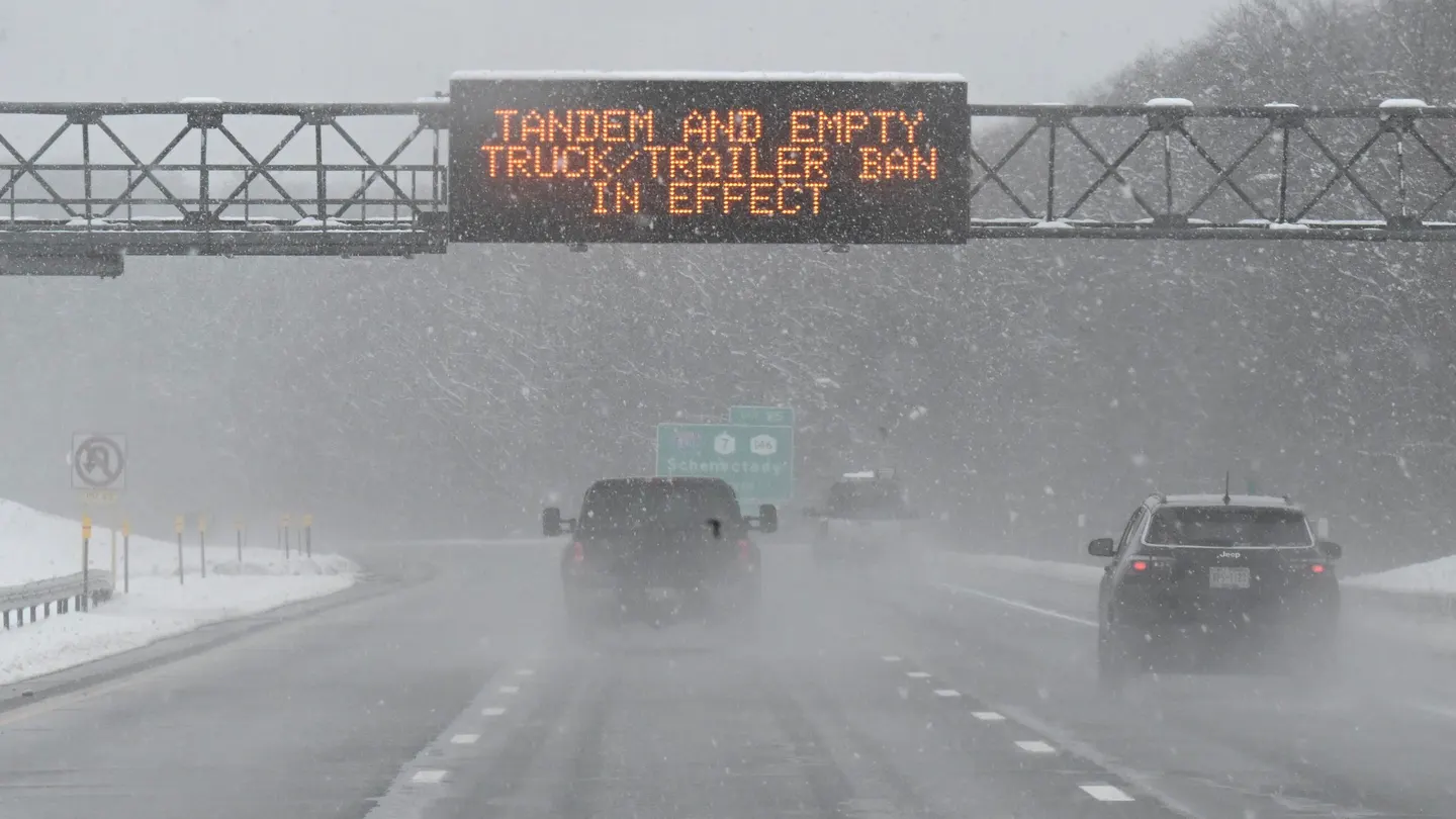
As lovebirds prepare for Valentine’s Day, a looming threat hangs over the Northeast in the form of an approaching winter storm. The region, accustomed to milder temperatures in recent weeks, faces the possibility of significant snowfall, though meteorologists warn of the uncertainty surrounding the forecast.
The storm is expected to originate in the Ohio Valley, gradually making its way towards the mid-Atlantic, central Appalachians, and southern New England. Initially, it will manifest as a mixture of rain and wet snow, gradually intensifying into a more formidable snowstorm by Monday night and into Tuesday, according to meteorologists at AccuWeather.
Cities like New York City and Philadelphia are bracing for lighter snowfall, with estimates hovering around an inch. However, areas just north of Manhattan and suburbs west of Philadelphia may experience higher snow accumulations. In Boston, the possibility of plowable snow exists, although the National Weather Service cautions that fine-tuning of the forecast is necessary to determine the storm’s exact track and intensity.
The greatest uncertainty lies in the region between I-78 and I-95, where the potential for heavier snowfall exists. Meteorologists emphasize that the extent of snowfall will hinge on the pace at which precipitation transitions into snow.
Despite the ambiguity in forecasts, concerns about travel disruptions loom large. Along the I-95 corridor, rain and fog could create hazardous driving conditions, while snowfall may lead to airline delays in major cities, warned AccuWeather.
The outcome of the storm hinges on various factors, including its strength and trajectory. “A weaker storm that fails to gather cold air and tracks farther to the south may fail to produce much snow,” noted AccuWeather. Conversely, if the storm intensifies rapidly near the Northeast coast, rain may transition into heavy, accumulating snow across cities like New York City, Philadelphia, and potentially Washington, D.C.
The timing of the storm couldn’t be more inconvenient for those hoping for an early spring. The Northeast has been basking in unseasonably warm weather, with temperatures expected to hover near 60 degrees Fahrenheit in the New York City metropolitan area on Saturday, according to the National Weather Service.
The potential snowstorm threatens to dash hopes ignited by Punxsutawney Phil and other weather-predicting animals on Groundhog Day earlier this week. Their prognostications of an early spring now seem challenged by the looming wintry weather.
As the Northeast braces for the storm’s impact, residents are urged to stay tuned to updated forecasts and heed advisories from local authorities. Whether the storm delivers a mere dusting or a significant snowfall, its arrival just before Valentine’s Day serves as a reminder of the unpredictability of weather and the need for preparedness in the face of nature’s whims.
Recent Posts
Categories
- 193cc Digital Assets2
- 5G1
- Aerospace & Defense46
- AI37
- Arts3
- Banking & Insurance11
- Big Data3
- Billionaires426
- Boats & Planes1
- Business328
- Careers13
- Cars & Bikes76
- CEO Network1
- CFO Network17
- CHRO Network1
- CIO Network1
- Cloud10
- CMO Network18
- Commercial Real Estate7
- Consultant1
- Consumer Tech180
- CxO1
- Cybersecurity68
- Dining1
- Diversity, Equity & Inclusion4
- Education7
- Energy8
- Enterprise Tech29
- Events11
- Fintech1
- Food & Drink2
- Franchises1
- Freelance1
- Future Of Work2
- Games141
- GIG1
- Healthcare78
- Hollywood & Entertainment186
- Houses1
- Innovation42
- Investing2
- Investing Newsletters4
- Leadership65
- Lifestyle11
- Manufacturing1
- Markets20
- Media193
- Mobile phone1
- Money13
- Personal Finance2
- Policy567
- Real Estate1
- Research6
- Retail1
- Retirement1
- Small Business1
- SportsMoney33
- Style & Beauty1
- Success Income1
- Taxes2
- Travel10
- Uncategorized8
- Vices1
- Watches & Jewelry2
- world's billionaires395
Related Articles
Uber Launches $200 Safari Experience in South Africa
Uber is set to unveil one of its most adventurous services yet...
By 193cc Agency CouncilSeptember 30, 2024Study Reveals World’s Best Cities for Singles: Tokyo Tops List
A recent study has identified the world’s best cities for singles, shedding...
By 193cc Agency CouncilFebruary 26, 2024Norwegian Cruise Ship Stuck with 2,000 Passengers Due to Illness
A Norwegian Cruise Line ship, the Norwegian Dawn, carrying over 2,000 passengers,...
By 193cc Agency CouncilFebruary 26, 2024Viking Cruises Tops List for Best Customer Service in 2024
Lauren Harvey, a seasoned travel advisor, is a strong advocate for Viking...
By 193cc Agency CouncilFebruary 24, 2024


Leave a comment