- Home
- Billionaires
- Investing Newsletters
- 193CC 1000
- Article Layout 2
- Article Layout 3
- Article Layout 4
- Article Layout 5
- Article Layout 6
- Article Layout 7
- Article Layout 8
- Article Layout 9
- Article Layout 10
- Article Layout 11
- Article Layout 12
- Article Layout 13
- Article Layout 14
- Article Sidebar
- Post Format
- pages
- Archive Layouts
- Post Gallery
- Post Video Background
- Post Review
- Sponsored Post
- Leadership
- Business
- Money
- Small Business
- Innovation
- Shop
Recent Posts
Severe Weather Alert : Heavy Snow, Tornadoes Expected

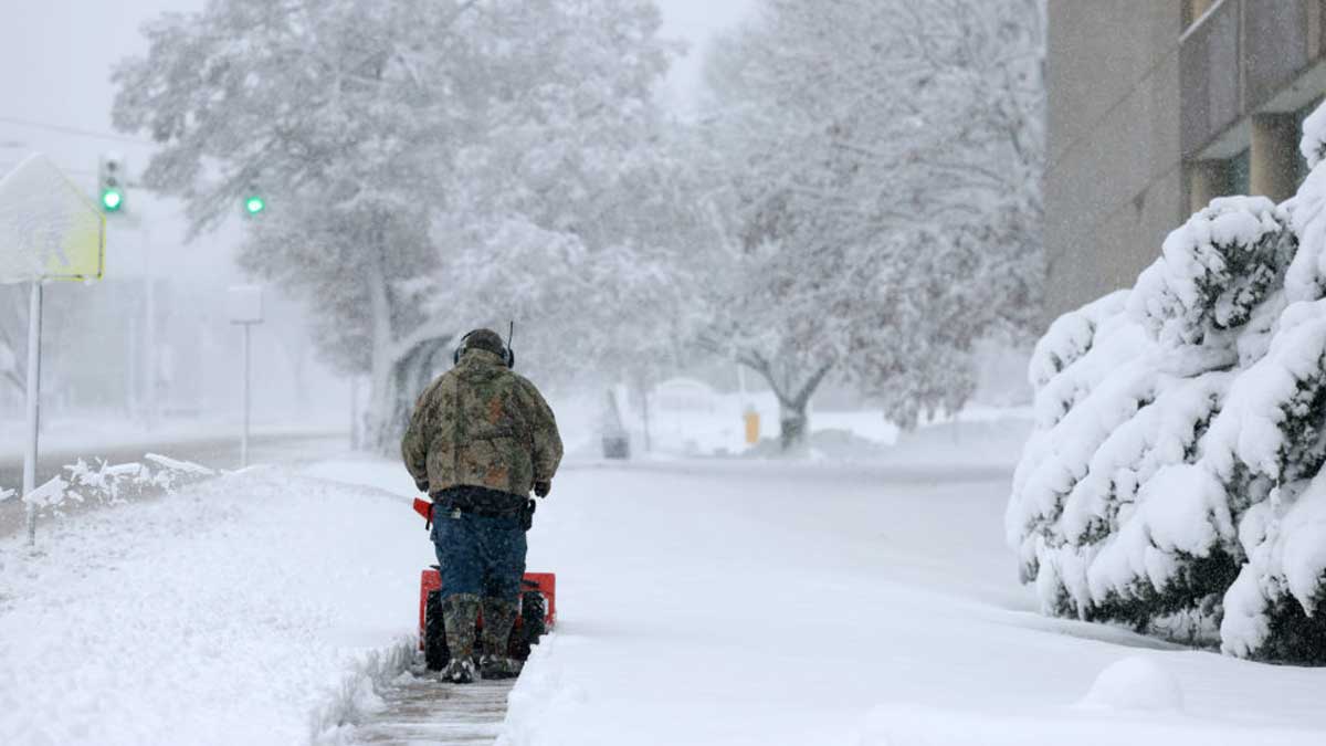
A mix of heavy snowfall and the threat of tornadoes is set to impact millions across the Midwest, Northeast, and Deep South this week. The National Weather Service (NWS) has issued alerts for various regions, warning of potentially dangerous weather conditions.
In Northeastern Wisconsin and Michigan’s Upper Peninsula, a winter storm watch is in effect, with forecasts predicting wet and heavy snow accompanied by wind gusts of up to 45 miles per hour. These conditions could lead to damage to tree limbs and power lines, according to the NWS station in Green Bay.
Along the shore of Lake Superior, including areas like Marquette, as much as two feet of snowfall is expected from Tuesday night through Wednesday night. Other parts of the region may see 8-12 inches of snowfall during the same period.
In the Northeast, including upstate New York, western Massachusetts, and most of northern New England, winter storms are expected to develop on Wednesday afternoon and continue through Friday. These storms could bring up to seven inches of snow and sleet, as well as wind gusts of up to 60 miles per hour, making travel difficult to impossible in affected areas, according to the NWS in Albany.
Moving south, another storm system is forecast to move through the Ohio, Tennessee, and Mississippi river valleys, bringing with it a high chance of severe thunderstorms. These storms could be accompanied by winds of up to 60 miles per hour, hail measuring up to two inches in diameter, and the potential for tornadoes.
A tornado watch has already been issued for central Kentucky, including Lexington and Bardstown, advising residents to remain vigilant and seek shelter in a basement or small central room if a tornado is spotted.
Further south, Florida and other parts of the southeast are also at risk of severe weather, including severe thunderstorms with strong winds, hail, and isolated tornadoes.
The severe weather conditions could result in power outages, with thousands already affected in southern Indiana and central Kentucky. The storms in these regions are expected to intensify around 11 a.m. local time on Tuesday.
This year has already seen its share of severe weather across the U.S., with California experiencing multiple atmospheric river storms, including one in February that broke rainfall records across the southern part of the state. In March, a major winter storm struck the Rocky Mountains, bringing over four feet of snow to parts of Colorado and leaving thousands without electricity.
Later in March, a large storm system struck the border of Indiana and Ohio, spawning a series of tornadoes, including a devastating EF-2 tornado in Richland County. These storms caused significant damage, destroyed property, knocked out power for thousands, and tragically claimed the lives of at least three people.
This year’s weather patterns in April are reminiscent of 2020, when a storm system struck the southeast, spawning a total of 24 tornadoes across Mississippi in April, including an EF-4 tornado that grew to about 2.25 miles wide in diameter. This storm system was one of the deadliest in state history, claiming the lives of 12 people and injuring over 100 more, according to the NWS.
Recent Posts
Categories
- 193cc Digital Assets2
- 5G1
- Aerospace & Defense46
- AI37
- Arts3
- Banking & Insurance11
- Big Data3
- Billionaires449
- Boats & Planes1
- Business328
- Careers13
- Cars & Bikes76
- CEO Network1
- CFO Network17
- CHRO Network1
- CIO Network1
- Cloud10
- CMO Network18
- Commercial Real Estate7
- Consultant1
- Consumer Tech180
- CxO1
- Cybersecurity68
- Dining1
- Diversity, Equity & Inclusion4
- Education7
- Energy8
- Enterprise Tech29
- Events11
- Fintech1
- Food & Drink2
- Franchises1
- Freelance1
- Future Of Work2
- Games141
- GIG1
- Healthcare78
- Hollywood & Entertainment186
- Houses1
- Innovation42
- Investing2
- Investing Newsletters4
- Leadership65
- Lifestyle11
- Manufacturing1
- Markets20
- Media193
- Mobile phone1
- Money13
- Personal Finance2
- Policy567
- Real Estate1
- Research6
- Retail1
- Retirement1
- Small Business1
- SportsMoney33
- Style & Beauty1
- Success Income1
- Taxes2
- Travel10
- Uncategorized8
- Vices1
- Watches & Jewelry2
- world's billionaires418
Related Articles
Netflix Secures 2027 and 2031 Women’s World Cup Rights
Netflix has clinched an exclusive streaming deal for the next two FIFA...
By 193cc Agency CouncilDecember 20, 2024Meta Fixes Facebook, Instagram, WhatsApp Outages
Meta, the parent company of Facebook, Instagram, and WhatsApp, faced significant outages...
By 193cc Agency CouncilDecember 12, 2024Roy Jones Jr. Confident He Can Beat Jake Paul, Issues Challenge
Boxing legend Roy Jones Jr. has made waves by declaring that he’s...
By 193cc Agency CouncilDecember 11, 2024Tsunami Warning Lifted After 7.0 Quake Off California Coast
A tsunami warning that affected large portions of northern California and Oregon,...
By 193cc Agency CouncilDecember 6, 2024


Leave a comment