- Home
- Billionaires
- Investing Newsletters
- 193CC 1000
- Article Layout 2
- Article Layout 3
- Article Layout 4
- Article Layout 5
- Article Layout 6
- Article Layout 7
- Article Layout 8
- Article Layout 9
- Article Layout 10
- Article Layout 11
- Article Layout 12
- Article Layout 13
- Article Layout 14
- Article Sidebar
- Post Format
- pages
- Archive Layouts
- Post Gallery
- Post Video Background
- Post Review
- Sponsored Post
- Leadership
- Business
- Money
- Small Business
- Innovation
- Shop
Recent Posts
Texas Braces for Hurricane Beryl’s Winds and Flooding

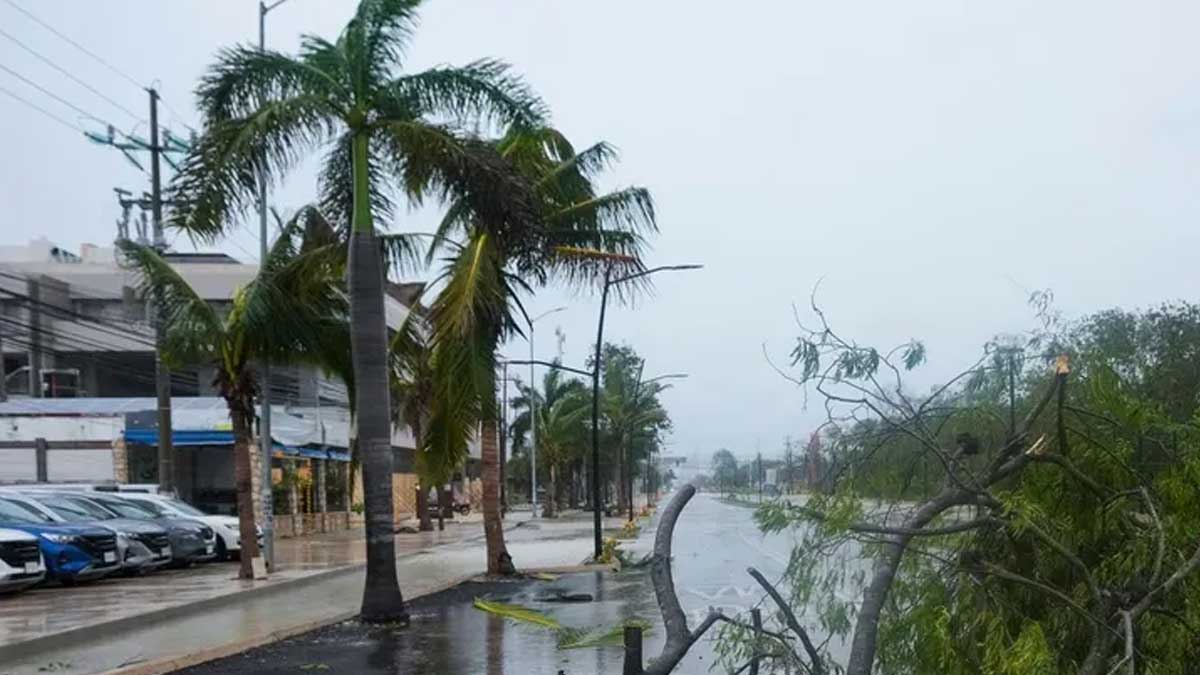
Texas is facing the imminent threat of hurricane-force winds and flooding as Hurricane Beryl moves closer, with potential impacts expected in southern Texas late Sunday and Monday. This warning from the National Hurricane Center (NHC) came shortly after the hurricane, now a Category 2 storm, made landfall in Mexico. The rapid progression of Beryl from the Caribbean to Mexico has prompted urgent alerts for residents and authorities along its projected path.
Hurricane Beryl has already caused significant destruction in the Caribbean, and its northwestern trajectory now targets the Texas coast. According to the NHC, there is an increasing risk of hurricane-force winds, life-threatening storm surge, and severe flooding for regions in northeast Mexico and the lower-middle Texas coast. These conditions are anticipated to begin late Sunday, underlining the urgency for preparedness in the affected areas.
Current forecasts predict that Beryl will continue its northwestward path before turning slightly northward towards Texas by early Monday. However, meteorologists caution that predicting the exact path of hurricanes several days in advance remains challenging. The storm’s trajectory could still shift, emphasizing the need for continuous monitoring and updates from weather authorities.
Warnings for portions of northeast Mexico and the lower-middle Texas coast are expected to be issued later on Friday. As of now, a hurricane warning is in effect for Mexico’s Yucatan Peninsula south of Cancun, with a hurricane watch covering areas to the north and west of Cancun. These warnings highlight the widespread nature of Beryl’s impact and the importance of vigilance in these regions.
In anticipation of the storm’s potential impact, Texas Governor Greg Abbott has directed the state Division of Emergency Management to enhance readiness levels. This order follows his previous directive for the department to issue advisories to the 39 state Emergency Management Council Agencies, urging them to prepare for the possible effects of Hurricane Beryl. The governor’s actions underscore the serious threat posed by the approaching storm and the need for comprehensive emergency preparedness.
Hurricane Beryl, the first hurricane of the 2024 season, has already set historical records. It became the earliest recorded Category 4 and later Category 5 Atlantic hurricane. The storm made a devastating landfall on Grenada’s Carriacou Island on Monday, causing widespread destruction across the Caribbean and Jamaica. The Associated Press reported at least nine fatalities attributed to the storm, highlighting its deadly nature.
The National Oceanic and Atmospheric Administration (NOAA) had forecasted that the 2024 Atlantic hurricane season would be the busiest on record. This prediction is partly based on the increasing severity of weather events, which scientists attribute to human-induced climate change. Rising ocean temperatures can intensify hurricanes, while elevated sea levels exacerbate storm surges, leading to more severe flooding. Additionally, the return of La Niña, a weather phenomenon that raises ocean surface temperatures, is expected to contribute to the heightened activity of the 2024 hurricane season. These factors combine to create a particularly dangerous environment for the formation and intensification of hurricanes like Beryl.
Recent Posts
Categories
- 193cc Digital Assets2
- 5G1
- Aerospace & Defense46
- AI37
- Arts3
- Banking & Insurance11
- Big Data3
- Billionaires449
- Boats & Planes1
- Business328
- Careers13
- Cars & Bikes76
- CEO Network1
- CFO Network17
- CHRO Network1
- CIO Network1
- Cloud10
- CMO Network18
- Commercial Real Estate7
- Consultant1
- Consumer Tech180
- CxO1
- Cybersecurity68
- Dining1
- Diversity, Equity & Inclusion4
- Education7
- Energy8
- Enterprise Tech29
- Events11
- Fintech1
- Food & Drink2
- Franchises1
- Freelance1
- Future Of Work2
- Games141
- GIG1
- Healthcare78
- Hollywood & Entertainment186
- Houses1
- Innovation42
- Investing2
- Investing Newsletters4
- Leadership65
- Lifestyle11
- Manufacturing1
- Markets20
- Media193
- Mobile phone1
- Money13
- Personal Finance2
- Policy567
- Real Estate1
- Research6
- Retail1
- Retirement1
- Small Business1
- SportsMoney33
- Style & Beauty1
- Success Income1
- Taxes2
- Travel10
- Uncategorized8
- Vices1
- Watches & Jewelry2
- world's billionaires418
Related Articles
Netflix Secures 2027 and 2031 Women’s World Cup Rights
Netflix has clinched an exclusive streaming deal for the next two FIFA...
By 193cc Agency CouncilDecember 20, 2024Meta Fixes Facebook, Instagram, WhatsApp Outages
Meta, the parent company of Facebook, Instagram, and WhatsApp, faced significant outages...
By 193cc Agency CouncilDecember 12, 2024Roy Jones Jr. Confident He Can Beat Jake Paul, Issues Challenge
Boxing legend Roy Jones Jr. has made waves by declaring that he’s...
By 193cc Agency CouncilDecember 11, 2024Tsunami Warning Lifted After 7.0 Quake Off California Coast
A tsunami warning that affected large portions of northern California and Oregon,...
By 193cc Agency CouncilDecember 6, 2024


Leave a comment